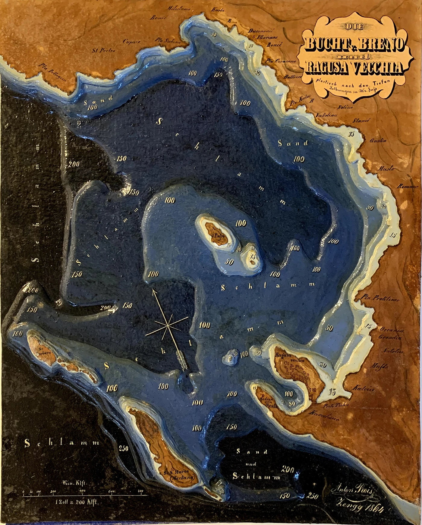
The problems of navigation lie not only in determining one’s position at sea and in plotting a course, but also in identifying the conformation of the seabed, especially when nearing the coast. A depth sounder is used to determine the sea’s depth below the vessel.
Large numbers of such measurements taken over time enable maps to be drawn which describe the conformation of the seabed by means of isobaths, lines of equal depth that are particularly important near ports.
Charts of this type, with masses of numerical data, were difficult to read, so versions were developed with depth indicated by varying shades of blue, lighter to darker for shallower to deeper water.
Antonio L. Rois Bathymetric model of the Bay of Breno and Ragusa Vecchia (Župa Dubrovačka and Cavtat) Oil-painted wood and paper, 1864 INV. 148
Heinrich von Littrow developed these maps and created three-dimensional models from them, passing on the technique to the students of the Academy of Commerce and Nautical Sciences, where he served as teacher and director from 1857 to 1863.
Questo sito utilizza i cookie per assicurarsi che tu possa avere la migliore esperienza sul nostro sito. Utilizzando tali servizi, accetti l'utilizzo dei cookie presenti sul sito.