The nautical instruments conserved by the Museum testify to the close relationship between technological evolution and navigation from the eighteenth century to the early twentieth. The collection includes various instruments used by the Mathematical-Nautical School of Trieste (1754–1809), the Academy of Commerce and Nautical Sciences (1809–1917), and subsequently the Nautical Institute.
In the early days of navigation it was necessary to keep the coast in sight. In the Mediterranean the Phoenicians began to sail the open sea using the first rudimentary navigational aids to reach their destination ports more quickly and therefore more profitably.
Over time, increasingly precise instruments were developed to determine a ship’s position and speed, and navigation allowed mapmakers to describe the entire world.
Satellite technology and digital cartography now make it possible to accurately determine a ship’s position, speed and route to its destination. However, sailors should still be familiar with traditional instruments and keep them close at hand.
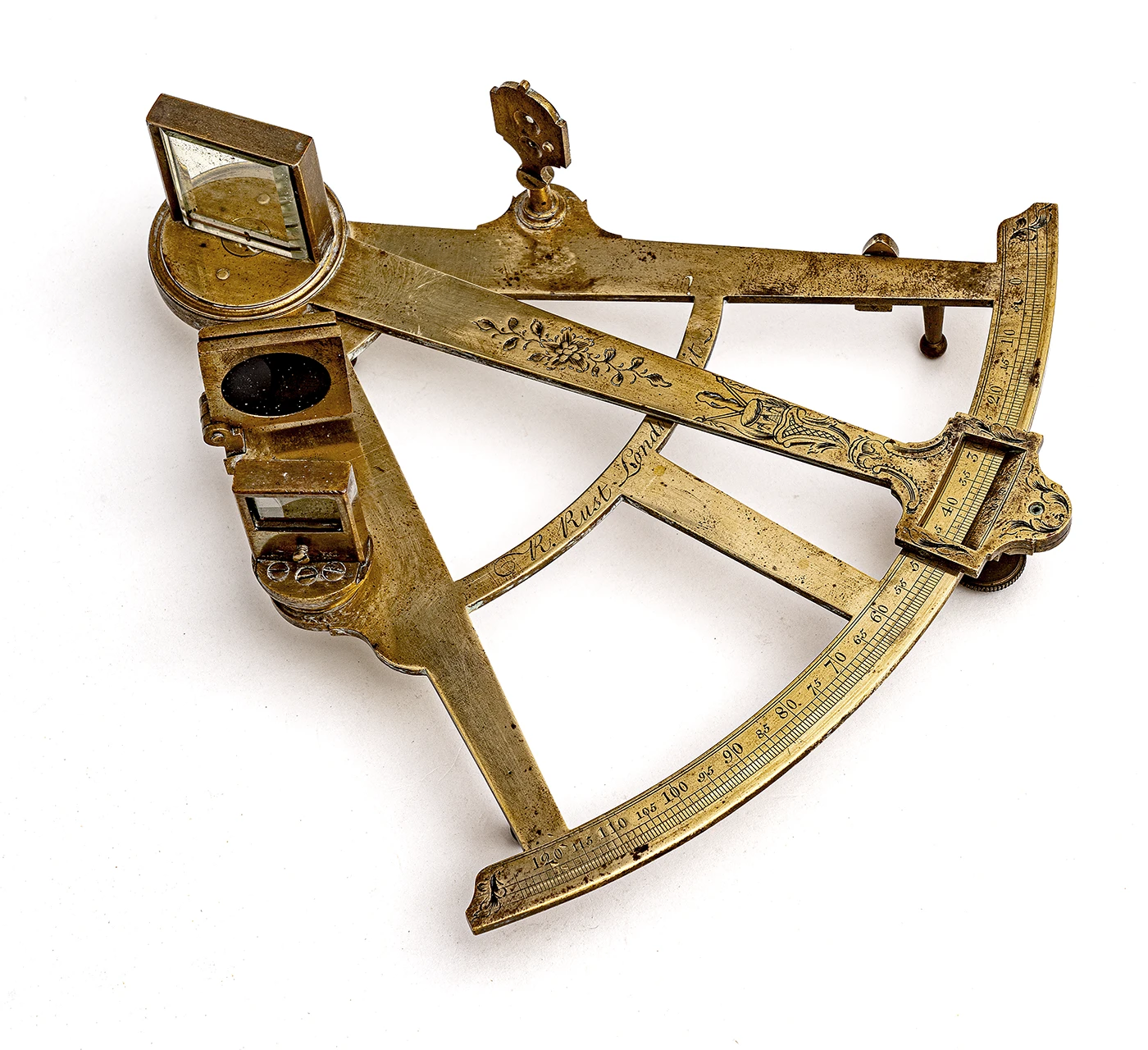
Richard Rust (London) Sextant Brass, second half of the 18th century INV. 260
Functions
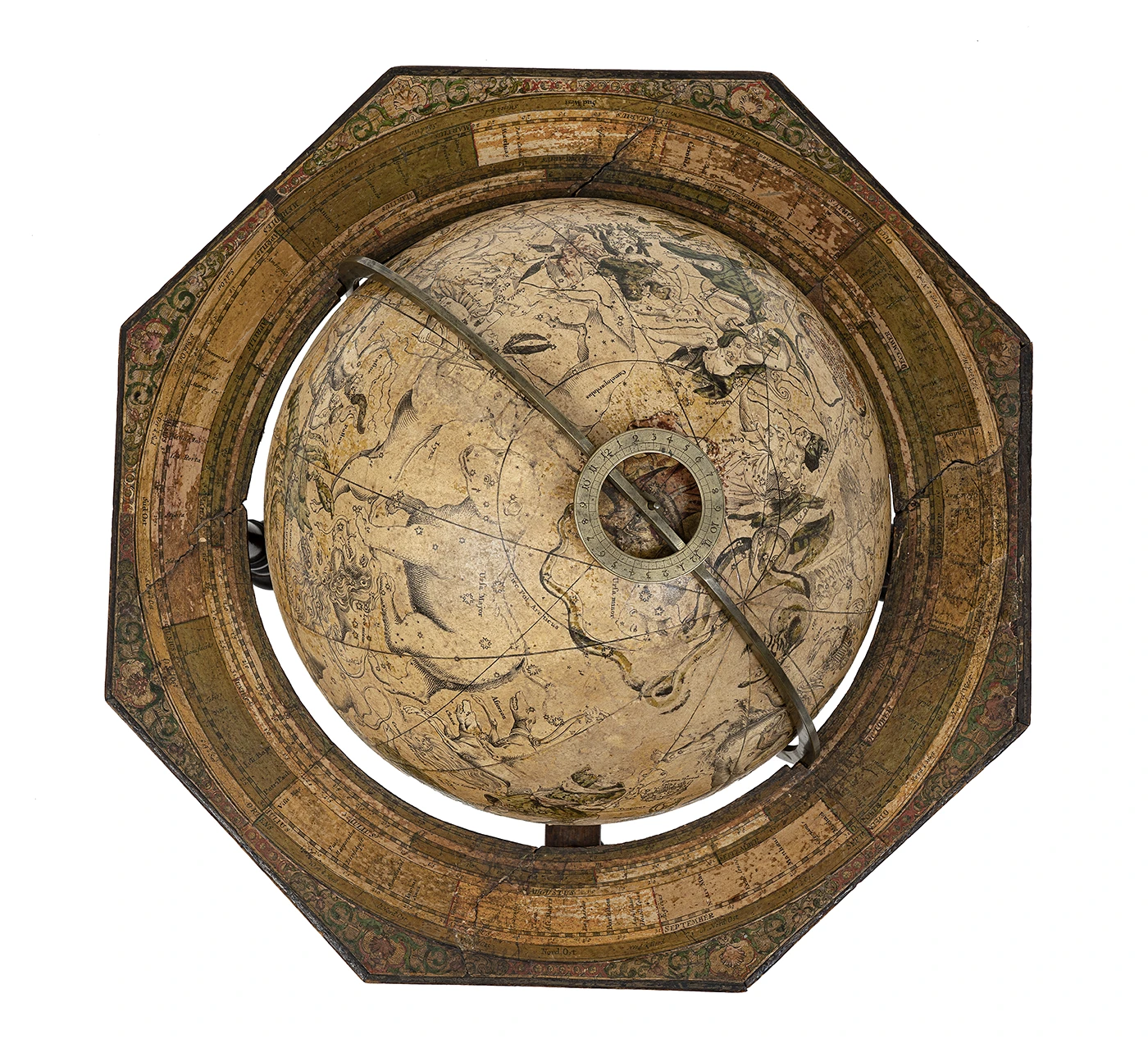
Globes of the world, celestial globes and armillary spheres help the teaching of the principles of astronomy and geography needed for the correct use of instruments that allow a ship’s position to be accurately determined.
Octants and sextants are instruments that measure the height above the horizon of a celestial body such as the sun or the pole star. Knowing the positions of the ship and the destination point, it is possible to plot a course, measured as the angle between this and the direction of north as shown on the compass.
Johann Gabriel Dopplemayer and Johann Puschner (Nuremberg) Celestial globe Wood and painted paper, 1728 INV. 238
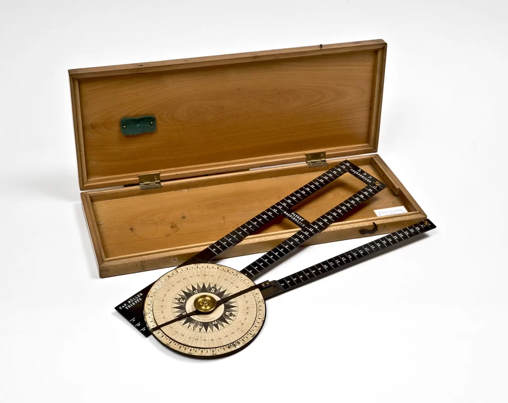
The dromoscope corrects compass errors, such as those arising from magnetic fields generated by the ship itself.
The sundial uses sunlight to indicate the time.
Ship logs record the vessel’s speed.
The barometer measures atmospheric pressure and the barograph records its values over time. This information makes it possible to predict imminent weather conditions taking into consideration the wind direction and the season.
Questo sito utilizza i cookie per assicurarsi che tu possa avere la migliore esperienza sul nostro sito. Utilizzando tali servizi, accetti l'utilizzo dei cookie presenti sul sito.